Listen carefully at Palo Alto Battlefield National Historical Park. You can almost hear a faint rumble of cannons. Or maybe it’s just the southeast breeze sweeping across the coastal plains, snapping the flags that mark the battle lines of two armies that clashed here in 1846.
The first battles of the Mexican-American War—at Palo Alto, Resaca de la Palma and Fort Texas in Brownsville, all within a 10 mile stretch—led to dramatic changes in both nations. The United States doubled its land area with the treaty that ended the war, claiming or buying land that is present–day Arizona, California, Colorado, New Mexico, Nevada, Oklahoma, Texas and Utah. And it all started in the Rio Grande Valley.
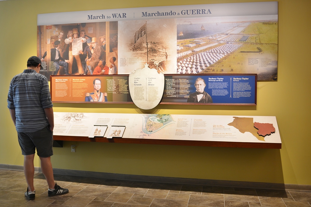
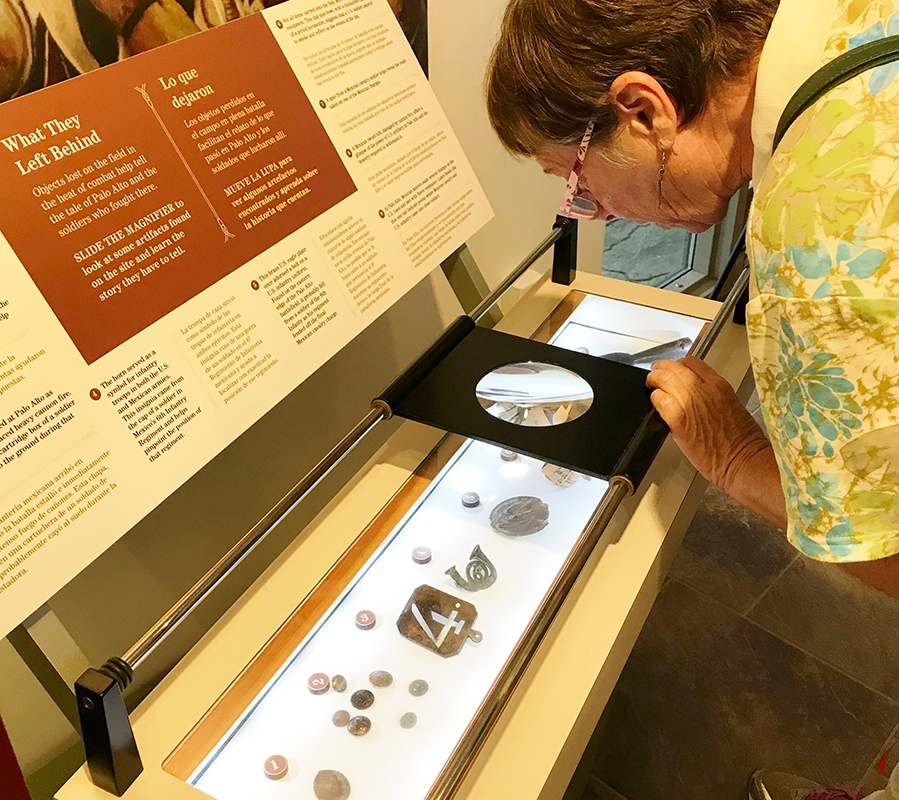
The Palo Alto Battlefield Park at the intersection of Highway 550 and Paredes Line Road immerses visitors in the era and the action of 162 years ago. Engaging, bilingual hands-on exhibits in the Visitors Center and interpretive panels across the battlefields place you on the scene. See what soldiers wore and what they carried. Rub your hands across cannon balls and replica cannons. Roll a magnifying glass over items recovered from this battlefield: uniform buttons, belt buckle, bullets, sword handle and more.
Anita Westervelt
Park archeologist Rolando Garza spread out a map for me with dots marking where hundreds of artifacts—debris from battle—are still buried and awaiting archeological excavation. Before heading outside, be sure to watch the park’s entertaining and captivating 15-minute video. You will emerge saying, “I didn’t know that. “Basically, the U.S. claimed its border with Mexico was the Rio Grande and Mexico believed otherwise. War was inevitable.
In a nutshell: General Zachary Taylor ordered 2,300 troops and 10 cannons to march from Port Isabel to relieve a siege at the newly built, six-sided earthen Fort Texas provocatively placed directly across from Matamoros. On May 8, 1846, the soldiers encountered 3,200 Mexican soldiers with 12 cannons blocking the Matamoros Road on the open plain named Palo Alto. The ensuing battle lasted for five hours. Cannonballs screamed over the half-mile separating the troops. Wagons and cannon carriages exploded, orders were shouted, horses galloped in charges, and blood from the dead and wounded soaked into the earth.
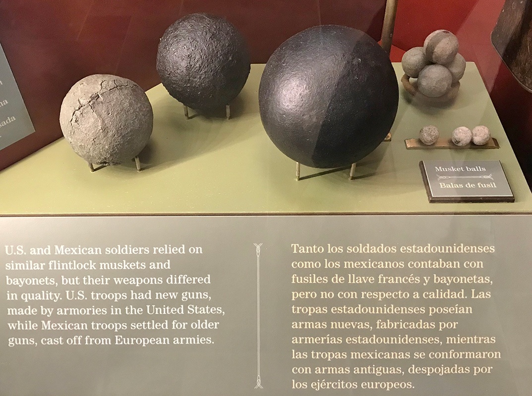
While the Mexican troops, renowned for their cavalry, outnumbered the Americans, the Americans had better artillery: newer cannons firing heavier cannonballs with a higher degree of accuracy. Nightfall brought a ceasefire and the Mexican army’s retreat with heavy losses, more than 100 dead. The next afternoon five miles south at Resaca de la Palma, Arista’s army waited for Taylor’s troops. The dense brush here cut the usefulness of both artillery and cavalry. Hand to hand combat in thickets followed.
Anita Westervelt
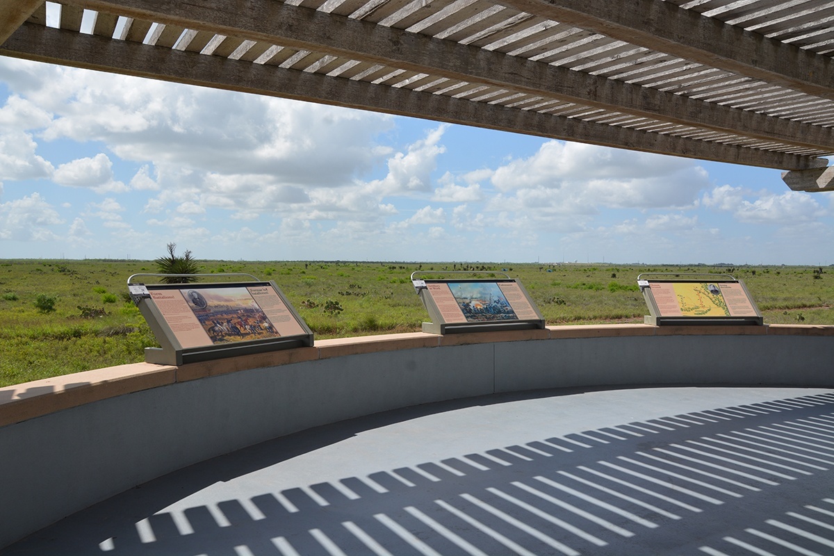
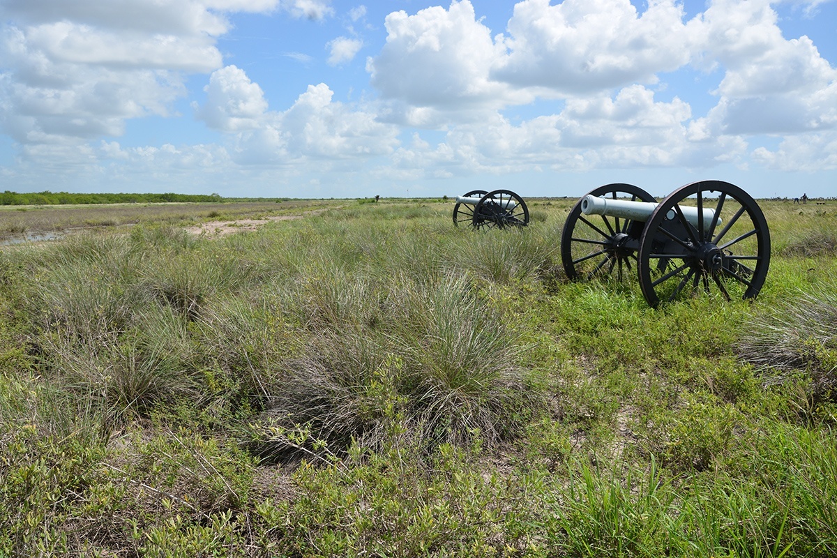
From the Palo Alto Visitor’s Center, it’s an easy half-mile walk on boardwalks and concrete paths to the shaded Overlook, where you look east to the two armies’ frontlines marked by pennants. Interpretive signs point out that Americans on the north faced the Mexicans about one-half mile to the south. Between them, needle-sharp gulf cordgrass and yuccas covered the flat, coastal prairie. You see no hiding places here. The dark promise of the cannon replicas enforces the battlefield silence. In contrast, striped lizards scurry across the paths into the colorful wildflowers where butterflies sip nectar.
Behind the Overlook, two cannons face the resaca, where black-necked stilts search for food. Nearby, fiddler crabs have made mud castles. To make what you see as authentic to the time as possible, Palo Alto park staff are restoring the 1846 natural landscape. Mesquite and cactus are being removed, and cordgrass is being restored, patch by patch.
Drive down Paredes Line Road (part of the Matamoros Road in 1846) or take the Battlefield Hike and Bike trail to the Resaca de la Palma Battlefield, which covers 33 acres. A half-mile walking loop in a resaca bend takes you through what remains of the battlefield. Picture it with thorny, dense chaparral, that made it impossible to see any distance. Today prairie milkweed and tiny white rain lilies soften the field where more than 170 soldiers died. Sit on benches under ebony trees and be cooled by the breeze.
Admission is free at the Palo Alto Battlefield, open daily 8-5, and Resaca de la Palma, open Tues.-Sat. 9-3. Free guided tours are offered Sun. at 2 p.m. and Tues. and Thurs. at 10, while a Ranger Program is presented at 10 Wed. Download the free NPS mobile tour app with 21 stops at the Visitors Center.
For dates of living history reenactments and other events, Check the Palo Alto Park website nps.gov/paal.