Drive west on Interstate 10 from the Hill Country, through beautiful desert mesas and mountains, and there’s no water in sight, right?
Not unless you know where to look. Rivers, springs and even waterfalls are hidden across West Texas.
Most folks know about the Rio Grande, which cuts through the Big Bend, and you may even know of San Solomon Springs, which fills the 1.3-acre pool in Balmorhea State Park.
But you probably don’t know about the 70-foot waterfall 143 feet below a cow pasture. It’s managed by the Texas Cave Management Association and accessible only by wetsuit-clad expert cavers with advanced vertical rope training.
The Rio Grande Wild and Scenic River, also known as the Lower Canyons, flows down from Big Bend National Park toward Amistad Reservoir near Del Rio—the most remote part of the state. The 83-mile canoe trip takes a week and requires extensive river paddling knowledge and wilderness experience. Help, if needed, can be days away, but only if you carry a satellite phone.
On the other hand, anybody can paddle and swim just west of the Hill Country. Here, the crystal-clear Nueces River is nothing like the muddy flows that empty into the Gulf of Mexico. You’ll find swimming pool-clear water in Lake Nueces as well as upstream, in a swimming hole in the town of Camp Wood named for its depth in feet, Quince (15).
It’s easy to take water for granted. But seeing and experiencing water in West Texas brings an appreciation of one of our state’s most important and sensitive resources.
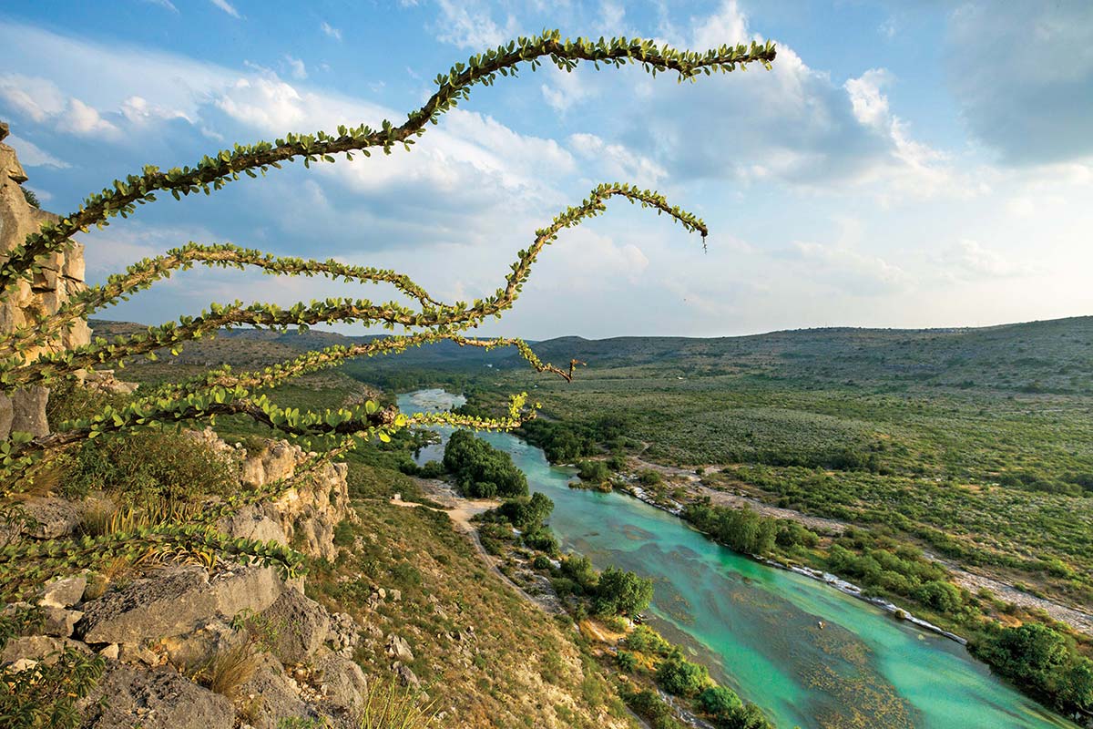
Ocotillo reaches out from a bluff overlooking Devils River State Natural Area, north of Del Rio. The river, part of the Rio Grande watershed in Southwest Texas, is one of the most pristine in Texas.
Erich Schlegel
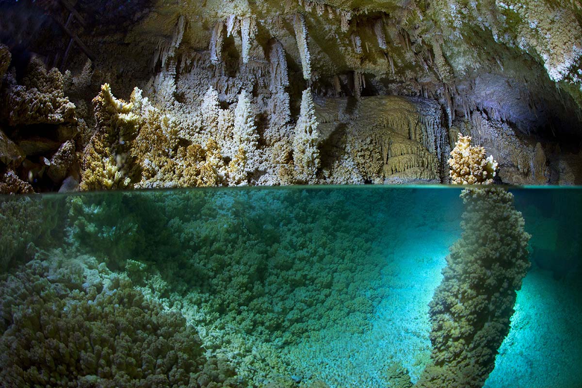
The Horseshoe Lake room sits beneath the dry, barren landscape of West Texas in the Caverns of Sonora, where the humidity is always about 98%.
Erich Schlegel
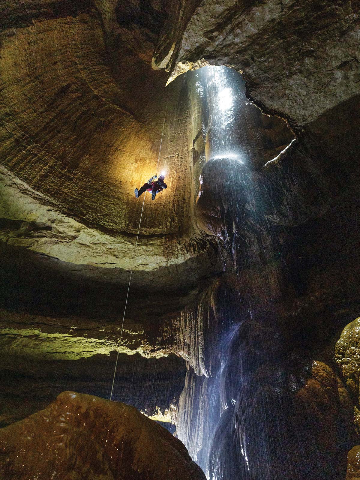
Austin cave expert Ethan Perrine descends a rope alongside a 70-foot underground waterfall in a cave below a West Texas cow pasture.
Erich Schlegel
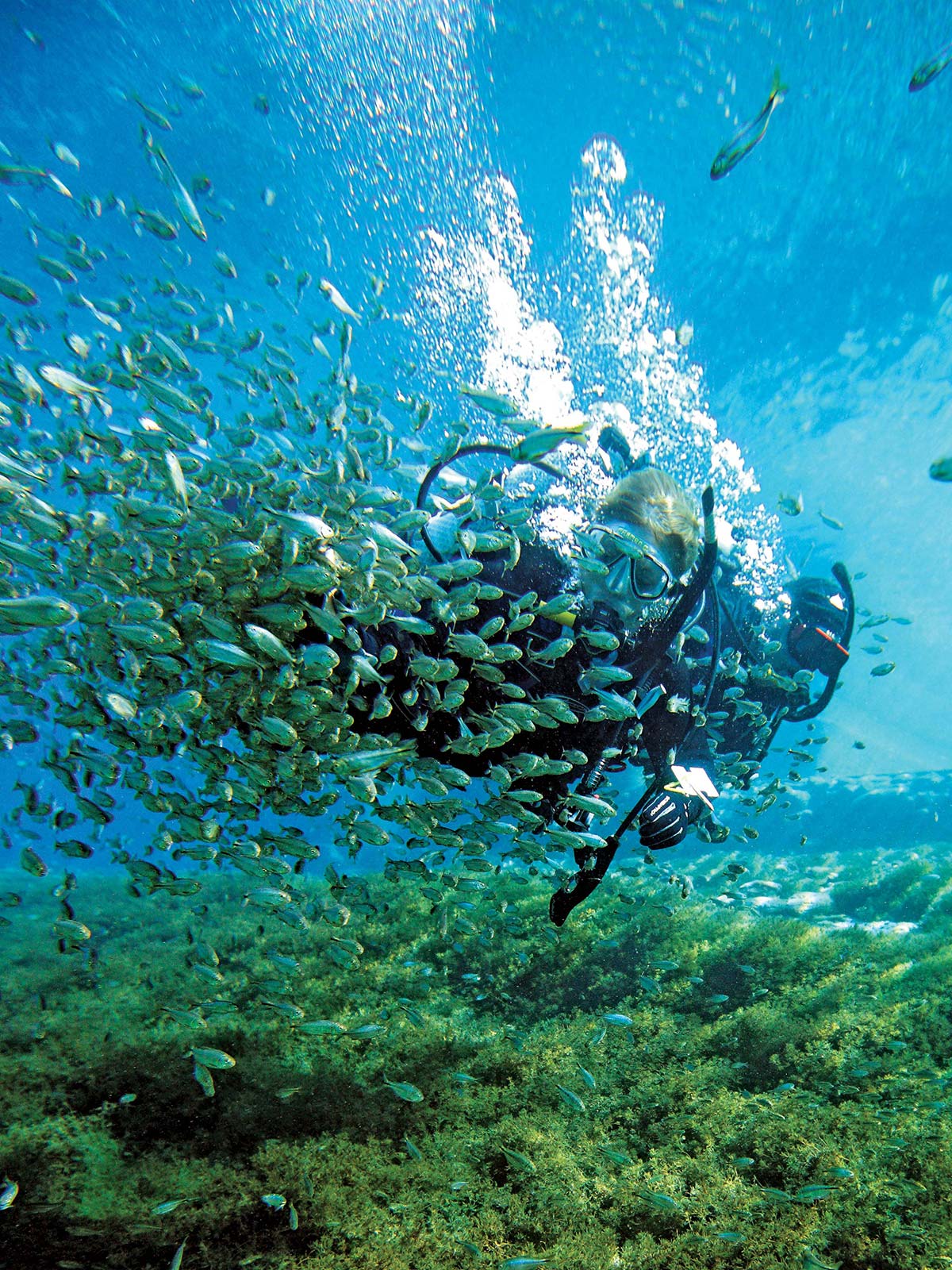
Divers join a school of fish in San Solomon Springs at Balmorhea State Park, home of the world’s largest spring-fed swimming pool. The springs have flowed out of the Chihuahuan Desert about 135 miles southwest of Midland for thousands of years.
Erich Schlegel
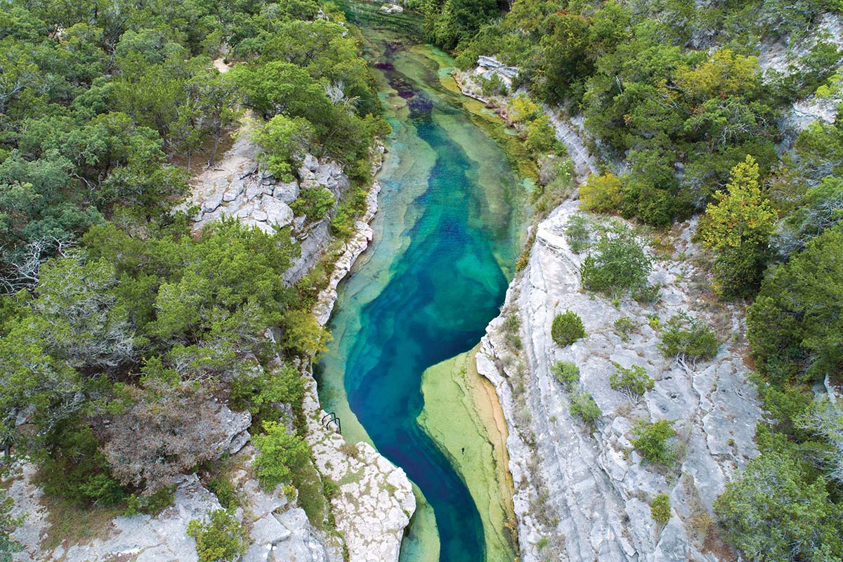
Blue Hole is a spring-fed swimming spot near the headwaters of the Frio River north of Leakey on the private property of the H. E. Butt Foundation Camp. Blue Hole reaches a maximum depth of about 30 feet.
Erich Schlegel
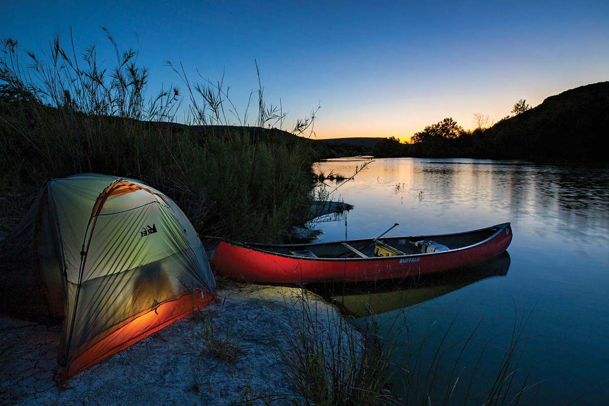
A campsite along the Devils River, which begins in northwest Sutton County and flows south for 94 miles, emptying into Amistad Reservoir on the Rio Grande.
Erich Schlegel
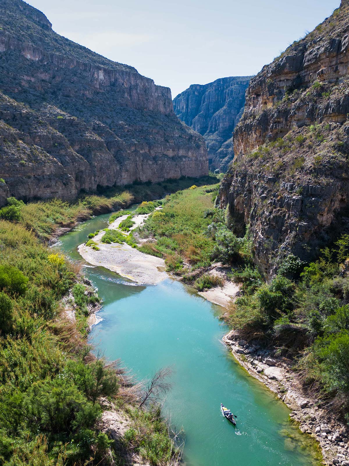
The Rio Grande Wild and Scenic River is the most remote part of the state. The heart of this stretch of the Rio Grande is an arduous 83 miles called the Lower Canyons, which offers spectacular scenery but requires extensive wilderness experience.
Erich Schlegel
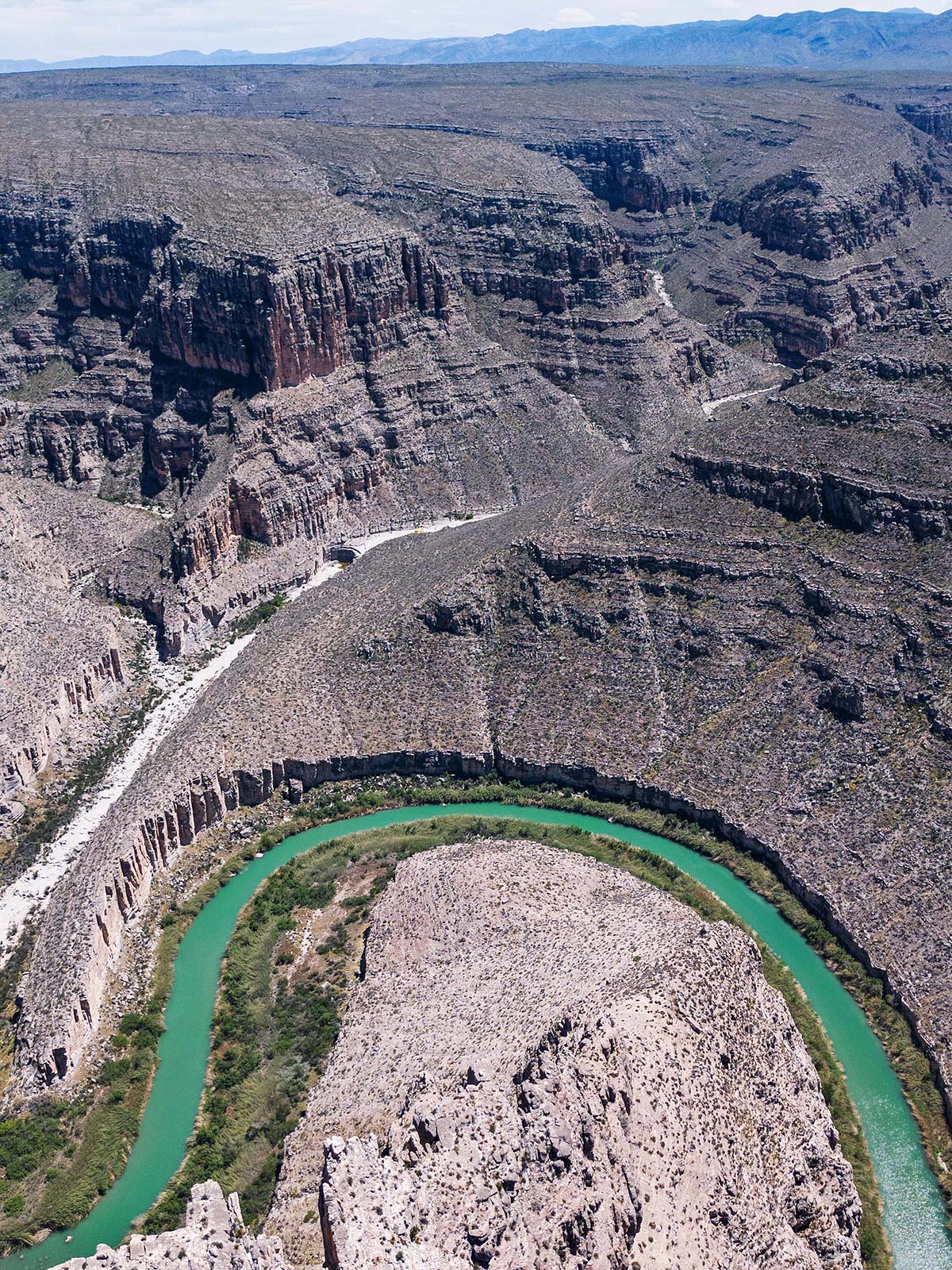
An aerial view of the Rio Grande Wild and Scenic River, which extends for 196 miles along the 1,865 miles of the Rio Grande.
Erich Schlegel